How the Northwest was lost & may be won
The Northwest has always been Auckland's public transport Cinderella, rarely invited to the public funding ball. How did this come about and what is the prognosis for the future?
[Updated: 4 July 2024 with an update from the NZ Government on NW rapid transit]
The Northwest of Tāmaki Makaurau/ Auckland is one of three key growth fronts in the city. But unlike the others - the Southern and Northern growth fronts - it is not currently served by rapid transit service. It looks like real rapid transit might finally be coming to the Northwest - eventually. But it has been a very long time coming. This makes it worth delving into the history of the North-west to get a sense of how we got to where we are now and what the prospects are for the future.

Massey - the suburban dream turned nightmare
The Northwest was and to quite an extent remains a “drive till you qualify” subregion, where lower housing costs are accompanied by higher transport costs and decreased quality of life due to the time spent travelling.
By 1961, the Northwestern Motorway (SH16) ran 11.5 kilometres from Pt Chevalier to Hobsonville Road to serve Auckland’s original airport at Whenuapai. In 1966 Auckland International Airport was opened and Whenuapai reverted to a military airport. This reduced the use of SH16 in the short term. But help was on its way with the suburbanisation of Te Atatū and Massey from the early 1960s in what was then somewhat of a public transport desert1.
In fact, Massey was the personification of suburban neurosis at the time, along with its middle-class doppelganger of Pakūranga. To get a feel for this, I strongly recommend watching the episode of Johnstone’s Journeys on Massey in 1978 available on Iwi Whitiāhua/ NZ on Screen, in which Ian Johnstone “explores the then new suburb of Massey in West Auckland — the latest instalment in what seemed, at the time, like an unending march of urban sprawl (which had already produced seemingly far-flung suburbs like Ōtara and Porirua).”

For Johnstone, Massey was “bafflingly lacking in community amenities … like so many others, Massey is just an infestation of houses, not a community grown around a centre…” It is worth reflecting on whether we are doing that much better with Paerātā, Plimmerton Farms or Rolleston today.
Massey was, and largely remains, a dormitory suburb requiring most people to travel to often distant employment locations. This means that strong public transport connections to the rest of the region are critically important.
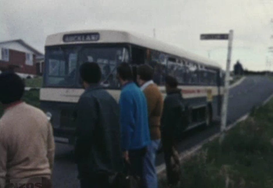
Back in the day, Whenuapai Bus Company provided what could only be described as a very thin service focused on connecting Henderson and Auckland City Centre, even though from 1979 it was fully publicly owned by the then Waitematā City Council. Its original focus was the rural areas of Whenuapai and Hobsonville, along with their respective air force bases. Despite the rapid residential growth in the Massey area in the 1960s and 1970s the Whenuapai Bus Company suffered from the same financial difficulties caused by increased motorisation and reduced public transport use that at the time beset almost every other bus operator in Aotearoa.
Deregulation of public transport
When the deregulation of public transport occurred in 1991, the Massey, Hobsonville and Whenuapai network was so complex that there were barely any discernible common routes, let alone route numbers, and most of the few trips operated had bespoke elements. There were very few formal bus stops, no timetable information at bus stops and no telephone enquiry service for non-ARC bus operations such as Whenuapai Bus Company. Remember that this is long before the advent of the internet, cell phones and trip-planning apps.
In fact, the entirety of Massey plus Te Atatū Peninsula was served by a single bus in the evening with trips from the city centre at 7:35 pm, 9:15 pm and 11:00 pm. While exceedingly resource-efficient, it was far from being customer-friendly, especially for people in Massey as, if there were any Te Atatū Peninsula passengers on board, it meant an additional 15-minute travel time doing the Te Atatū Peninsula loop.
2006 Passenger Transport Network Plan
In the early part of the century, the fate of the North-west was tied up with the service hierarchy established in the then Auckland Regional Transport Authority’s (ARTA) 2006 Passenger Transport Network Plan.
The good thing about the Passenger Transport Network Plan is that it, for the first time, set an ambitious goal for Auckland to double public transport patronage from 50 million per year at the time of publication in 2006 to 100 million in 2016.
While it included one of the early attempts to define a rapid transit network for Auckland, the bad thing is that the Northwestern Motorway corridor was only defined as a “Quality Transit Corridor,” not a Rapid Transit corridor. Even though a quality transit corridor was defined as having “extensive priority including bus lanes, signal priority in congested corridors,”2 it did not include the separate right of ways.

When planning for the further widening of the Northwestern Motorway was underway around the same time, Transit New Zealand, then the state highway road controlling authority used the Quality Transit Corridor designation in the Passenger Transport Network Plan as justification for not providing more than some non-continuous bus lanes on the Northwestern Motorway with significant gaps around interchanges.
At the same time, there was also some fear that investment in higher-order bus services for the Northwest would undermine investments just getting underway in double-tracking of the Western Line that was a key part of what was known as Project DART (Developing Auckland’s Rail Transport). This was even though at the 2006 Census, there was a grand total of just six people in the Northwest who used rail as their main means of travel to work.
Northern Strategic Growth Area
From around 2005, the then Waitakere City Council planned the Northern Strategic Growth Area (known as NorSGA). This urbanised the Hobsonville Peninsula and extended the Metropolitan Urban Limit north from Hobsonville Road to the Upper Harbour Motorway to enable the creation of new employment land in Hobsonville and a new subregional centre at Westgate, later known as Northwest Centre.
The formation of the Super City, amalgamating seven territorial authorities and the Auckland Regional Council into a single unitary authority, took place in 2010. The new council inherited the Regional Growth Strategy and the 2010 Auckland Regional Land Transport Strategy, with the Metropolitan Urban Limit at the Upper Harbour Motorway. However, the new Auckland Plan in 2012 overturned the Metropolitan Urban Limit and established a new Rural Urban Boundary which created significant greenfield growth fronts in the Northwest, North and South. The Northwestern growth front includes Whenuapai, Kumeū and Huapai.
Kumeū and Huapai
This new north-western growth front, along with the extension of metropolitan water and wastewater to Kumeū and Huapai in the early part of the century, triggered the rapid urbanisation of the area without all of the social, retail and transport infrastructure to support it.
Kumeū and Huapai are connected to the Northwestern Motorway by possibly the single-busiest two-lane state highway in Aotearoa with an average daily traffic volume of 37,026 before the pandemic in 2019. While there was limited bus service, this was stuck in the same congestion on State Highway 16 as the rest of the traffic.
Delayed public transport investment
A key principle of good transport/ land use integration is that land use and transport investment should be sequenced and designed in such a way that promotes both good urban form and prioritises sustainable transport choices. This did not take place in Northwest, continuing a pattern that kicked off with the initial urbanisation of Massey in the 1960s, focused on car-oriented growth, centred on the Northwestern Motorway.

Developments included:
1952: Four-lane motorway opens from Great North Rd to Te Atatū Road.
1955: Motorway extended from Te Atatū Road to Lincoln Road
1957: Motorway extended 1km from Lincoln Road to Lincoln Park Ave.
1961: Motorway extended from Lincoln Park Ave to Hobsonville Rd.
1979: Motorway built from Newton Rd to Western Springs.
1981: Motorway extended from Great North Road to Motions Rd.
1983: Gap closed from Motions Road to Great North Rd.
1988: A direct link between Southern and Northwestern motorways opened.
1989: Northwestern Motorway connected to Grafton Gully.
1991: Widening from four to six lanes between Te Atatū Rd and Rosebank Rd.
1992: Widening from four to six lanes between Newton Road and Great North Road interchanges. was widened from four to six lanes.
1992: Hobsonville Road terminus converted to a signalised intersection.
1993: Widening from four to six lanes between Rosebank Rd and Great North Rd.
1997: Full interchange connection to the Rosebank Peninsula employment area.
2006: Northwestern Motorway connected to Northern Motorway.
2011: Motorway extended to Brigham Creek Road.
2012-2016: Motorway widened to eight lanes from Western Springs to Great North Rd and from Rosebank Road to Te Atatū; nine lanes from Great North Road to Rosebank Road and six lanes from Te Atatū Road to Hobsonville Rd.
2017: Motorway connected to the then-new Waterview Tunnel and the Southwestern Motorway.
To give a relative sense of motorway and public transport improvements, it was only in 2010 that Massey, Whenuapai and Hobsonville got hourly Sunday bus service. Before that, Sunday buses were every 2-3 hours.
And it took until the implementation of the New Network in West Auckland for Kumeū and Huapai to get hourly bus service, and Sunday service for the first time in many years, and for Te Atatū Peninsula to get hourly Sunday bus service, previously two-hourly.
Interim Northwestern Bus Improvements
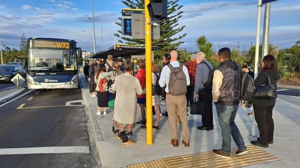
In response to pressure to finally get moving towards rapid transit in the Northwest, Waka Kotahi and Auckland Transport implemented the Interim Northwest Bus Improvements on 12 November 2023. This included the Western Express (WX1) running every 10 minutes, from 7am to 7pm, seven days a week and every 15 minutes early morning and late evening between Westgate and the city centre, alongside other bus service improvements, including frequent service connecting to key WX1 stops. It provided temporary bus stops at Westgate, and fairly basic interchanges at the Te Atatū and Lincoln Rd, plus some improvements to motorway bus shoulder lanes.
It also included significant bus service improvements to the Northwest, including half-hourly service from Kumeū and Huapai, and hourly service from Helensville, connecting to the the WX1 service at the Northwest Centre.
Within five months, the WX1 service had carried more than 275,000 passengers and bus patronage in the Massey/ Westgate area was up 25 per cent on pre-pandemic levels3. From April 2025, the WX1 will be run by a fleet of 20 electric double-decker buses to meet surging demand. Frequency really is freedom.
Better late than never, the Westgate Bus Station
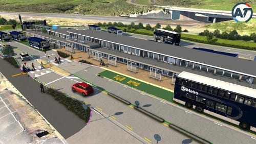
A key element of the WX1 and planning for rapid transit in the Northwest is a bus interchange at the Northwest Centre in Westgate, linking local buses to the planned rapid transit corridor on the Northwestern Motorway.
But, as in the words of the world-famous in New Zealand Mainland Cheese ad from 1981, “good things take time.” A lot of time. Planning for this bus interchange started in 2005. Now, a generation later, there are still only interim kerbside bus stops at the Northwest Centre. But at least planning for a permanent facility is finally underway.
This facility, expected to be complete in mid-2026, will bring Westgate up to the standards of the Northern Busway stations on the affluent North Shore, opened between 2005 and 2008.
Where we are now
On 14 June 2024, Waka Kotahi and Auckland Transport lodged confirmed designations decisions on the Notices of Requirement with Auckland Council for Northwest Auckland's future transport projects.
It includes these projects expected to be delivered in the next 10 to 30 years:
A future rapid transit corridor between Redhills North and Kumeū-Huapai, including stations in Kumeū and Huapai.
A new state highway corridor extending the North Western Motorway from Brigham Creek Road to east of Waimauku. This is identified as a Road of National Significance in the Government Policy Statement 2024.
A future SH16 interchange at Brigham Creek Road.
Future upgrades to local transport connections in Whenuapai, Redhills, Kumeū-Huapai and Riverhead.

This is in addition to the planned Te Ara Hauāuru/ Northwest Rapid Transit between Brigham Creek and Auckland City Centre on the Northwestern Motorway corridor.
This includes:
Rapid transit on a dedicated corridor –along the corridor which could be along, or either side of the Northwestern Motorway
Station locations, and facilities – such as seating, passenger information displays, CCTV, lighting and bike racks.
Access and connections to local bus services – improvements to the supporting transport network (including feeder bus services, walking and cycling).
This project will directly link into the rapid transit route from Brigham Creek to Kumeū/Huapai mentioned above.
On 4 July 2024, the Government confirmed bus rapid transit as the preferred mode and an indicative alignment and station locations for the Northwest Rapid Transit.
According to the Government “[Waka Kotahi] NZTA is investigating ways to provide a cost effective, value for money transport solution and looking into ways to build the busway in stages to provide west Aucklanders with benefits sooner.
“In the coming weeks and months, [Waka Kotahi] NZTA will be speaking with local boards, key stakeholders, and providing the community with updates on the preferred option, including station locations, local connections, and the order in which the busway is constructed.
“In the meantime, work is underway to deliver a new local bus station at Westgate with [Waka Kotahi] NZTA expecting the station to be up and running by mid-2026. The station will support the Western Express (WX1) service which launched last year and saw more than 100,000 passengers within the first three months of launching.
This is all great news and a sign that better things may well be possible for Northwest Auckland. And as they say, better late than never.4”
Final thoughts
Anyone born when work started on the Northwestern Motorway would have had their Super Gold card seven years ago. In Aotearoa, you get Super Gold at 65.
Anyone moving into Massey in the 1960s shouldn’t have to wait three generations to get decent public transport.
Anyone moving into Kumeū or Huapai in the early 2000s shouldn’t be waiting a generation to see a reasonable base level of public transport.
Even with all of the of stars appearing to come into alignment, construction of Northwest Rapid Transit is still a few years away.
All of that is way, way too long.
Auckland Motorways, Waka Kotahi, 2008, page 18
Auckland Passenger Transport Network Plan, Auckland Regional Transport Authority, 2006, page16
New Zealand Government media release, 4 July 2024


